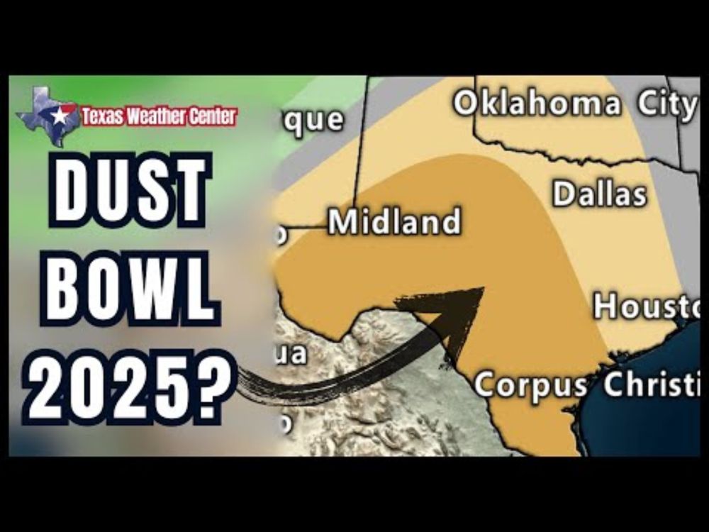
Severe Weather Targets Texas in Two-Day Strike
Enjoy the last quiet day of weather across Texas, because we’re going to be busy on Wednesday and Friday! A dryline will move east to Interstate 35 Wednesday afternoon. West of the dryline, we’ll experience gusty west winds and a very dry airmass, which brings extreme wildfire danger and blowing dust. Isolated to scattered severe storms are possible after 3 PM in North Texas and Northeast Texas. With the strongest storms, we may see large hail, localized damaging winds, and even a tornado. However, these storms will move east of Texas by 10 PM on Wednesday. Thursday will serve as an in-between day, but the extreme wildfire danger will persist across the western third of Texas. High-impact weather conditions are expected to affect Texas on Friday. In the western half of the state, watch for westerly wind gusts reaching up to 55 mph, relative humidity values dropping below 20 percent, and widespread blowing dust. Similar to last week, significant disruptions to aviation and road travel may occur due to reduced visibility and crosswinds, along with the ongoing severe wildfire danger. The cool front and dryline are set to move across the remainder of Texas by Friday evening. This will bring gusty west winds and blowing dust to the rest of the state. We can’t rule out a few severe storms in Far East Texas on Friday afternoon; however, if the system moves at a faster pace, we may not see much storm activity at all. Overall, warm to hot weather will continue across Texas over the next five days, with some cooler temperatures expected on Friday and Saturday in the western third of the state. Join this channel to get access to perks: https://www.youtube.com/channel/UCoIfgmxArIATc2EpHD3W9EA/join Check out our current LIVE STREAM: https://texasweather.video/ Our FREE WEATHER APP: https://texasweather.app/ GET ALERTED when in danger of severe storms and tornadoes! https://weathercallservices.com/tx-storm-chasers-nexgen Our SOCIAL PLATFORMS: https://linktr.ee/texasstormchasers We are grateful for all donations - Paypal@texasstormchasers.com VIDEO CHAPTERS: 0:00 - Introduction 0:57 - Calm Today, Storms & Wind Tomorrow (HRRR Model) 2:36 - Tomorrow's Severe Storm Risk 3:21 - Extreme Wildfire Risk in Texas 4:31 - Long-Range Weather Forecast (GFS Model) 5:35 - Damaging Winds on Friday in Texas 7:53 - Friday's Severe Storm Risk 8:16 - Five-day temperature Forecast 9:54 - Mid-March Weather Outlook 10:31 - Baldyinchiefisms & Conclusion #texas #texasweather #weather #abilene #alpine #amarillo #austin #beaumont #beeville #bigbend #brownsville #brownwood #canadian #childress #collegestation #coriscana #corpuschristi #crashythecoldfront #dalhart #dallas #davidreimer #delrio #denton #derecho #dfw #dfwmetroplex #dumas #eaglepass #elcampo #elpaso #flashflood #flood #fortstockton #fortworth #galveston #georgetown #gorillahail #granbury #hail #hereford #houston #hurricane #idabel #killeen #longview #lubbock #lufkin #marfa #mcallen #midland #news #odessa #pampa #paristx #perryton #plainview #rain #rgv #roundrock #sanangelo #sanantonio #severe #sherman #shreveport #storm #stormchasers #storms #stormsurge #supercell #temple #texarkana #texas #texasfire #texasflood #texasstormchasers #texasweather #TexasWildfire #texoma #today #todaynews #todaysweather #tornado #txwx #tyler #uvalde #vernon #victoriatx #waco #Weather #weatherforecast #wichitafalls #wildfire #wind #windy #winter
Top Bluesky Posts
www.youtube.com/watch?v=018W...

You may also like
Trump RUNS TO GOLF and GETS PROTESTED EVERYWHERE
TEXAS: Two Big Weathermakers On The Horizon
JASMINE CROCKETT is PRESIDENTIAL material and it SCARES the crap out of incompetent MAGA Women!
Amid economic struggles, Ukrainians celebrate International Women's Day with flowers
Red States DESCEND Into MORE CHAOS as Disease Spreads
Fear grows in Kenya for HIV patients as US aid cut halts drugs | REUTERS
LIVE: Federal workers protest at Senate over budget cuts and Musk’s DOGE
A Rare Multi-Day Storm Outbreak Is Coming…
My Favourite Canadian Books